Search
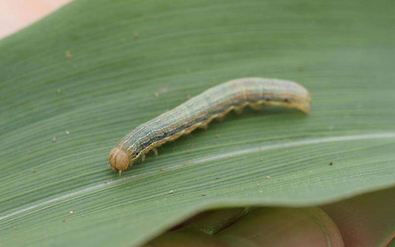
Reports of Pyrethroid Failures for True Armyworm Caterpillar Management
True armyworm caterpillars reached thresholds in oats and wheat in many areas of South Dakota recently. Management efforts to reduce populations had varying levels of success, with SDSU Extension receiving numerous reports of pyrethroid insecticide failures.
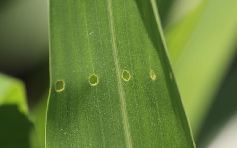
European Corn Borer Caterpillars Infesting Conventional Corn in South Dakota
European corn borer caterpillars have been observed in conventional corn at several South Dakota locations. Indicators for the presence of European corn borer caterpillars in corn are a line of straight holes in the upper leaves that is often referred to as "shot-hole injury."
Suspect Herbicide Resistance in Your Fields? SDSU Can Help!
Submission form to screen weeds for herbicide resistance in South Dakota.

SDSU Extension to host 4th annual Specialty Crop Field Day
August 28, 2024
This free, family-friendly event will feature a series of presentations and field tours related to small- to mid-scale commercial vegetable production research trials. Field tours will feature SDSU Extension research plots of cucumbers, tomatoes, melons, onions, peppers and broccolini.
Margin Protection Crop Insurance for Corn in South Dakota
Farmers may be interested in exploring different aspects of crop insurance during the current agricultural conditions of low commodity prices and high input prices. One alternative available is Margin Protection crop insurance.

Dakota Food Rx and high tunnel research support local producers
September 25, 2024
SDSU Extension has supported the growing local foods movement for more than 20 years. This year, those efforts have included a pilot produce prescription program and expanded high tunnel research.

SDSU Extension Farm to School supports 'feeding kids great food’
September 05, 2024
In 2024, 69 schools in South Dakota reported serving local beef in school meals in what’s commonly called Beef to School, a component of the Farm to School program supported by SDSU Extension.

SDSU Extension hosts free life story writing workshops via Zoom
September 06, 2024
South Dakota State University Extension and South Dakota Humanities Scholar Molly Barari will host a creative life story writing workshop for genealogy lovers.
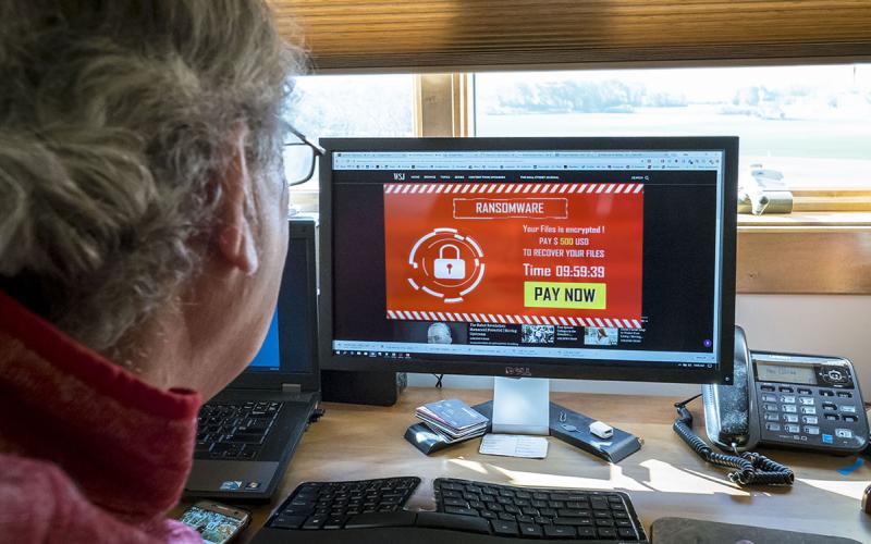
Ag Cybersecurity and Social Engineering 101
Social engineering is manipulating individuals to share confidential information and compromise security. By understanding the basics of social engineering, stakeholders can take proactive steps to ensure the resilience of agricultural systems against cyber threats.

What should you do before or after any cyber security breaches?
Preparation is critical for managing cybersecurity breaches in agriculture, where digital tools and data are increasingly integral to operations. Learn what you can do before, during, and after a security breach to protect your operation in the event of a breach.