Search
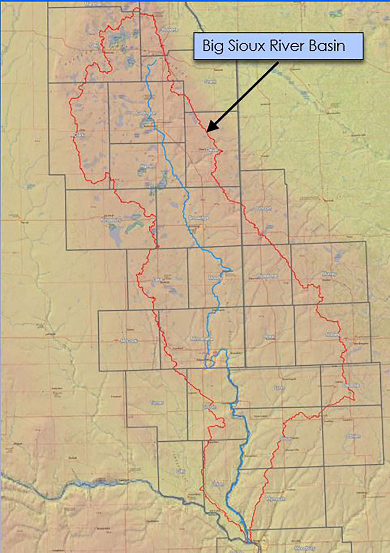
Big Sioux River Flood Information System Sees Heavy Use During Spring 2019
The Big Sioux River Flood Information System is the result of a combined effort between the SD Department of Environment and Natural Resources, local governments, and private industry, to create a product that can be used to predict the impact of flood events in the Big Sioux River Basin.
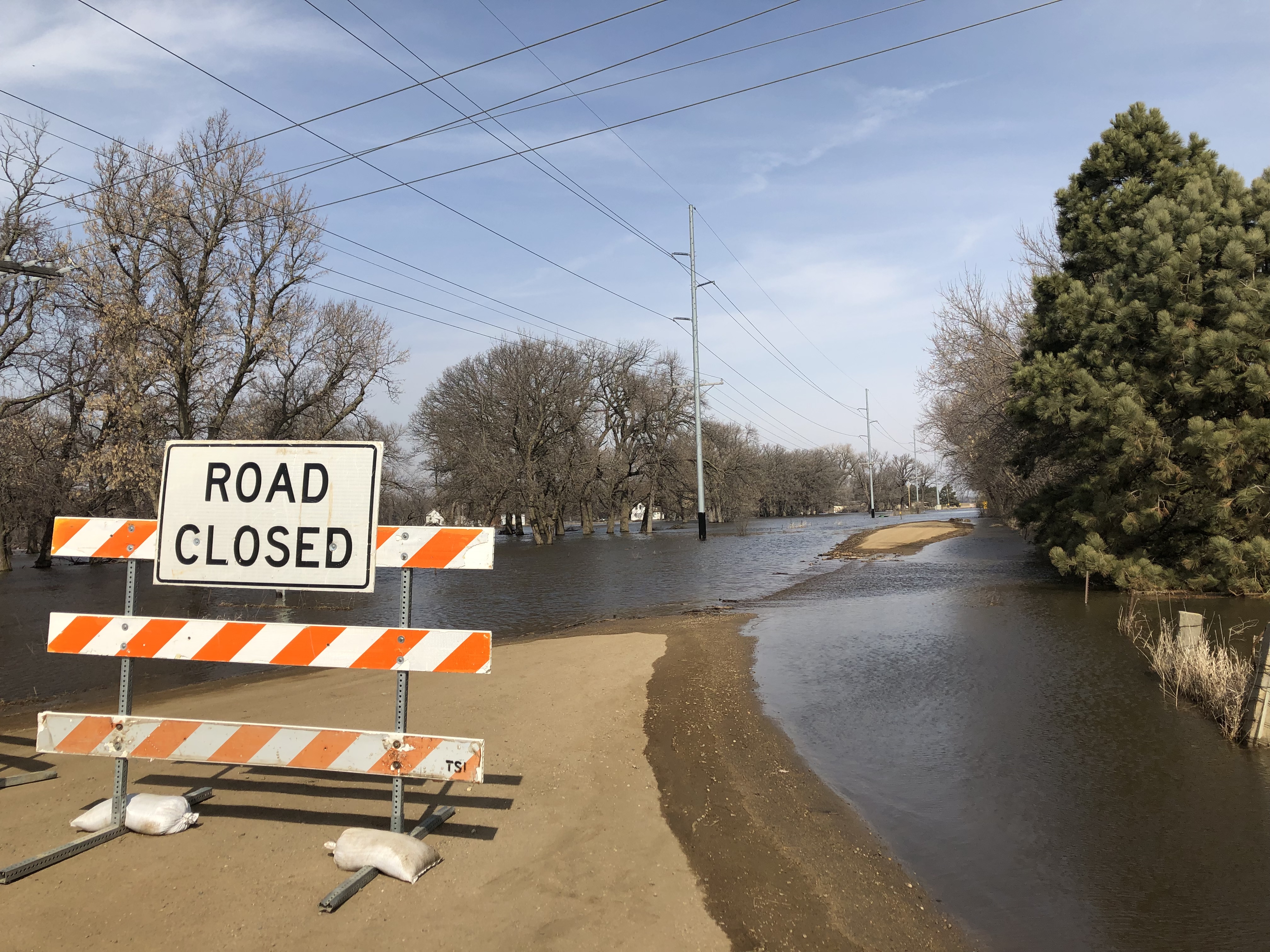
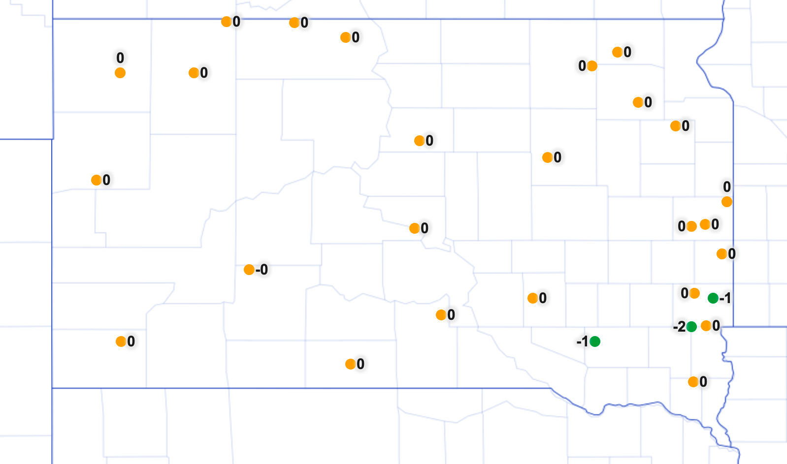
Floods Continue With a Wet Outlook
As April unfolds, major flooding continues along the Eastern rivers. The James River is at crest in Brown county the first week of April and will slowly recede while maintaining flood level for much of April.

An identification guide of common Diseases of Dry Peas in South Dakota
A guide depicting common diseases of Dry Peas in South Dakota
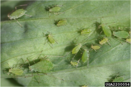
Soybean Aphids in South Dakota
Factsheet on Soybean Aphids in South Dakota

2017-2018 Multi-State Organic Oat Variety Trial Results
The tight production margins currently present in agriculture have increased interest in growing organic oats.
South Dakota Land Use Trends (2012-2017)
Significant education efforts for natural resource conservation have occurred in South Dakota during the last five years. Many stakeholder groups have brought awareness for soil health and water quality to the forefront.

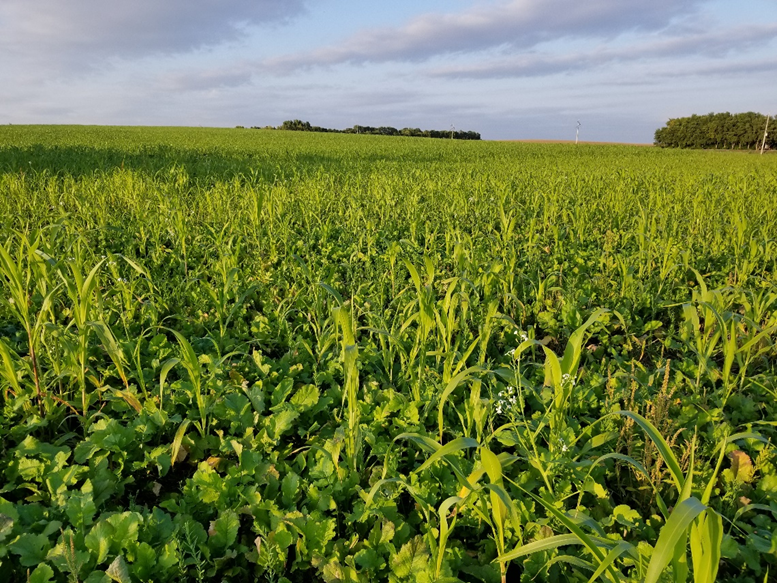
Instinct HL and Nitrogen Management Effect on Winter Wheat Yield
Nitrogen (N) additives to control N losses through volatilization, denitrification, and leaching are widely used in the Midwest. Slowing the conversion of nitrogen fertilizers to nitrate may lessen leaching and denitrification losses if precipitation or soil becomes saturated.
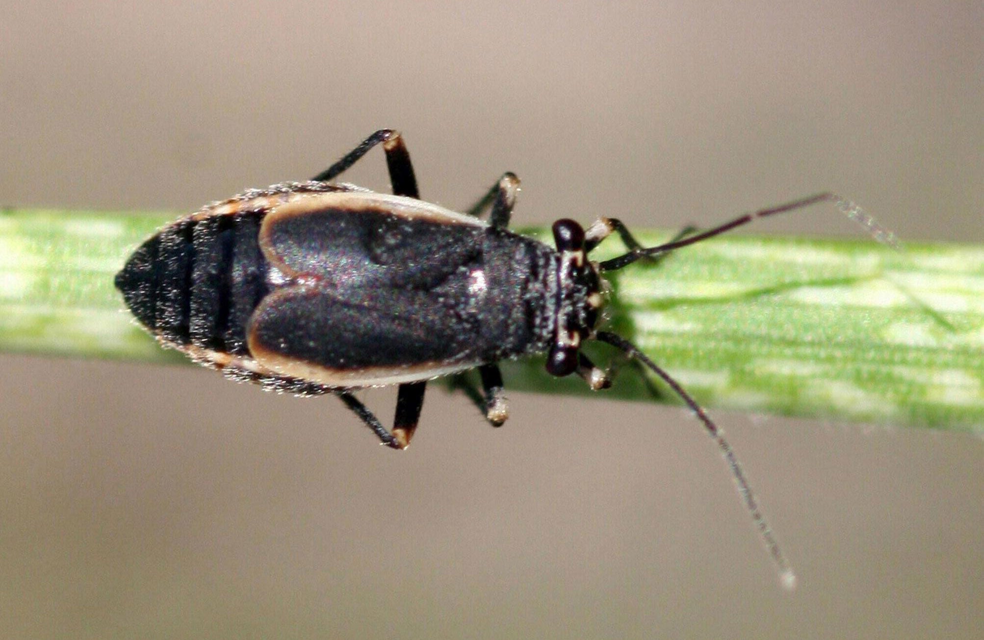
Be on the Lookout for Black Grass Bugs
It’s time to begin scouting pasture and wheat for the presence of black grass bugs. Last year, we saw the highest populations in areas of Central and Southwestern South Dakota. If left untreated, black grass bug populations tend to increase year after year.
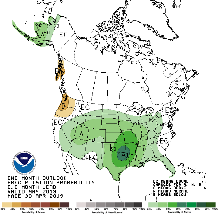
May 2019 Climate Outlook: April Showers Bring May Showers?
The precipitation outlook for May does not show much promise of relief from moisture, as wetter than average conditions are slightly more favored than drier conditions. In addition, cooler than average temperatures are more likely for the first half of May and could continue for much of the month.
Use the SD Spray Tool for Inversion Detection and Weather for Pesticide Application
The SD Mesonet Spray Tool provides real-time weather data for pesticide applicators. This dedicated website for pesticide applicators uses the SD Mesonet weather data, which is updated every five minutes.