Search
Get to Know Your Local Emergency Management Director
The warmer weather and spring migration this March have us all thinking of better days ahead. Unfortunately, it also has us thinking about flooding again this spring.

South Dakota Water and Community Symposium to be Held July 26
July 22, 2022
SDSU Extension will host a one-day South Dakota Water and Community Symposium on Tuesday, July 26 from 9:30 a.m. – 2:30 p.m. CDT at the Raven Precision Agriculture Center on the South Dakota State University campus in Brookings.
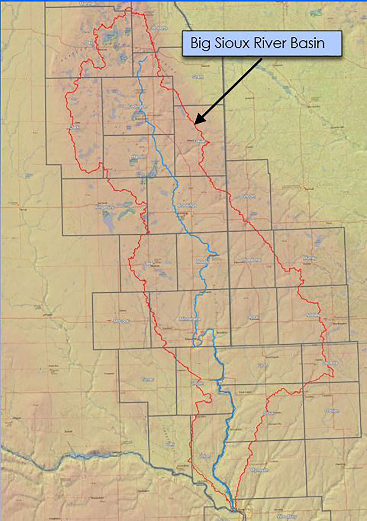
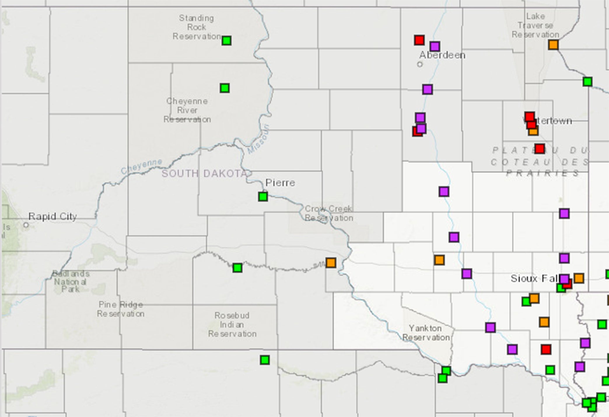
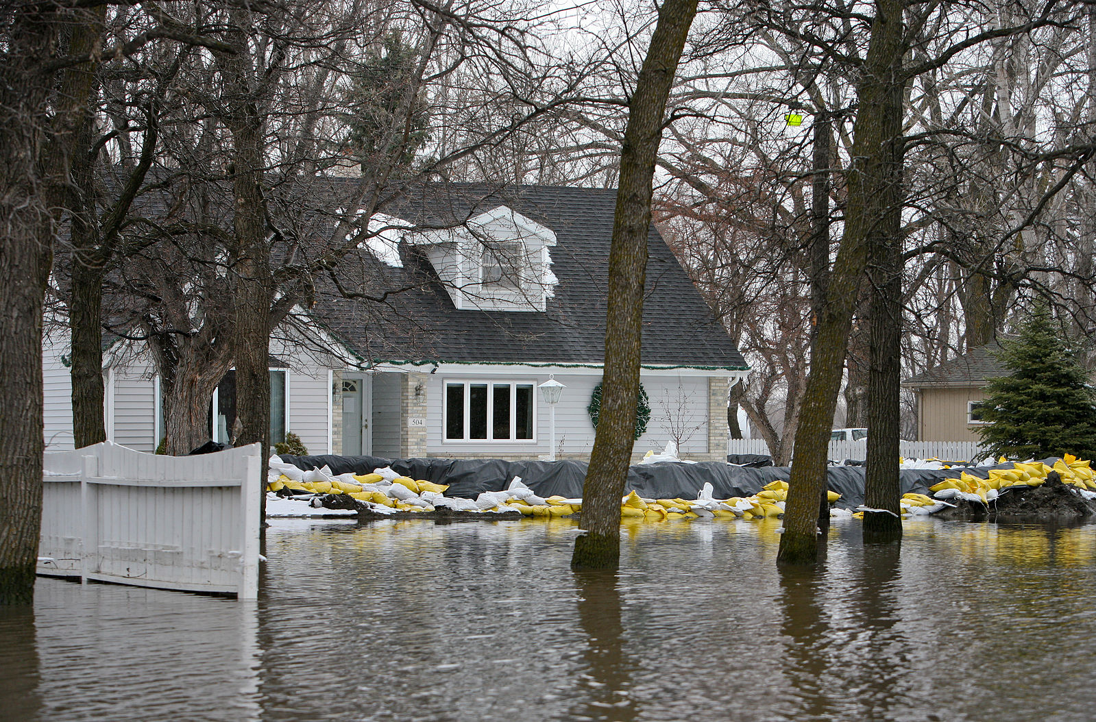
Big Sioux River Flood Information System Sees Heavy Use During Spring 2019
The Big Sioux River Flood Information System is the result of a combined effort between the SD Department of Environment and Natural Resources, local governments, and private industry, to create a product that can be used to predict the impact of flood events in the Big Sioux River Basin.
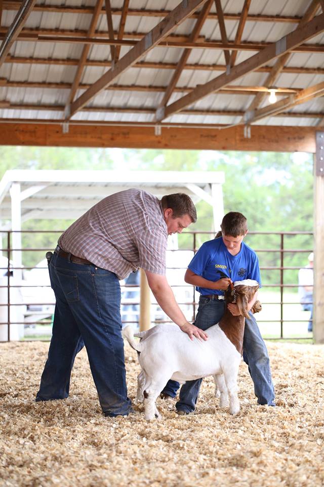
Bringing Home Your 4-H Goat Project
Sales and transport is a stressful time for any animal. Reducing stress factors due to transitions start before the actual purchase of your new project. Managing proper nutrition and disease management are just a couple factors to help your project get off to a great start.

Late Plant Crop Insurance Dates
Crop insurance late plant dates are fast approaching for planting small grains in South Dakota. Late plant dates for corn, soybean, and sunflower are nearing as well. Producers will want to work with their crop insurance agent to explore planting options and reporting of prevent plant areas.
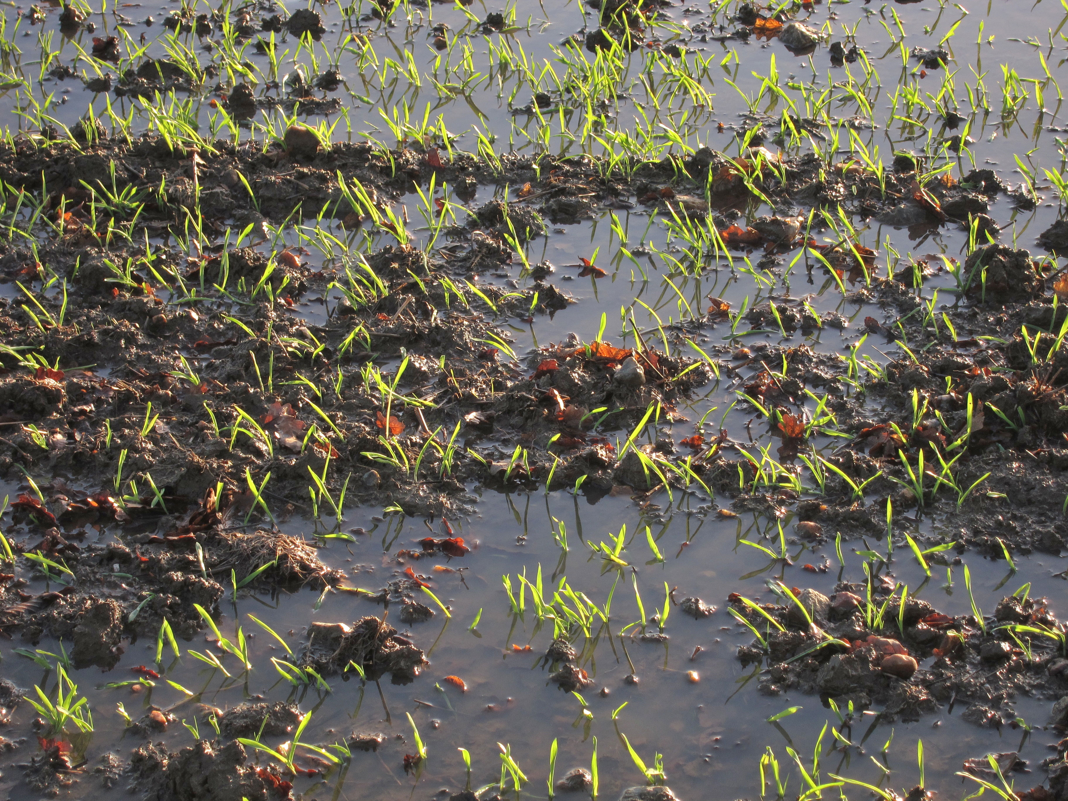
Wet Feet in Wheat
Given the widespread wet conditions present this spring, there are many areas in winter wheat fields with both ponding and saturated (or waterlogged) soils. Producers may want to consider soil conditions and evaluate extended weather forecasts when deciding whether or not to retain a winter wheat this spring.

Flood Insurance
The higher amounts of snow this year will increase the chance of flooding and the potential water damage to homes and residential properties. Now is the time to consider purchasing a flood insurance policy.
Managing Flooding Around Home Structures
As South Dakota and our surrounding neighbors begin to deal with the consequences of spring snowmelt and the dramatic flash flooding that came about from the region’s most recent winter storm, we can only hope that conditions begin to improve quickly.

Inundaciones: sugerencias útiles
La primavera en el Medio Oeste siempre trae el riesgo de inundaciones, sea por la nieve que se derrite o por lluvia en exceso.
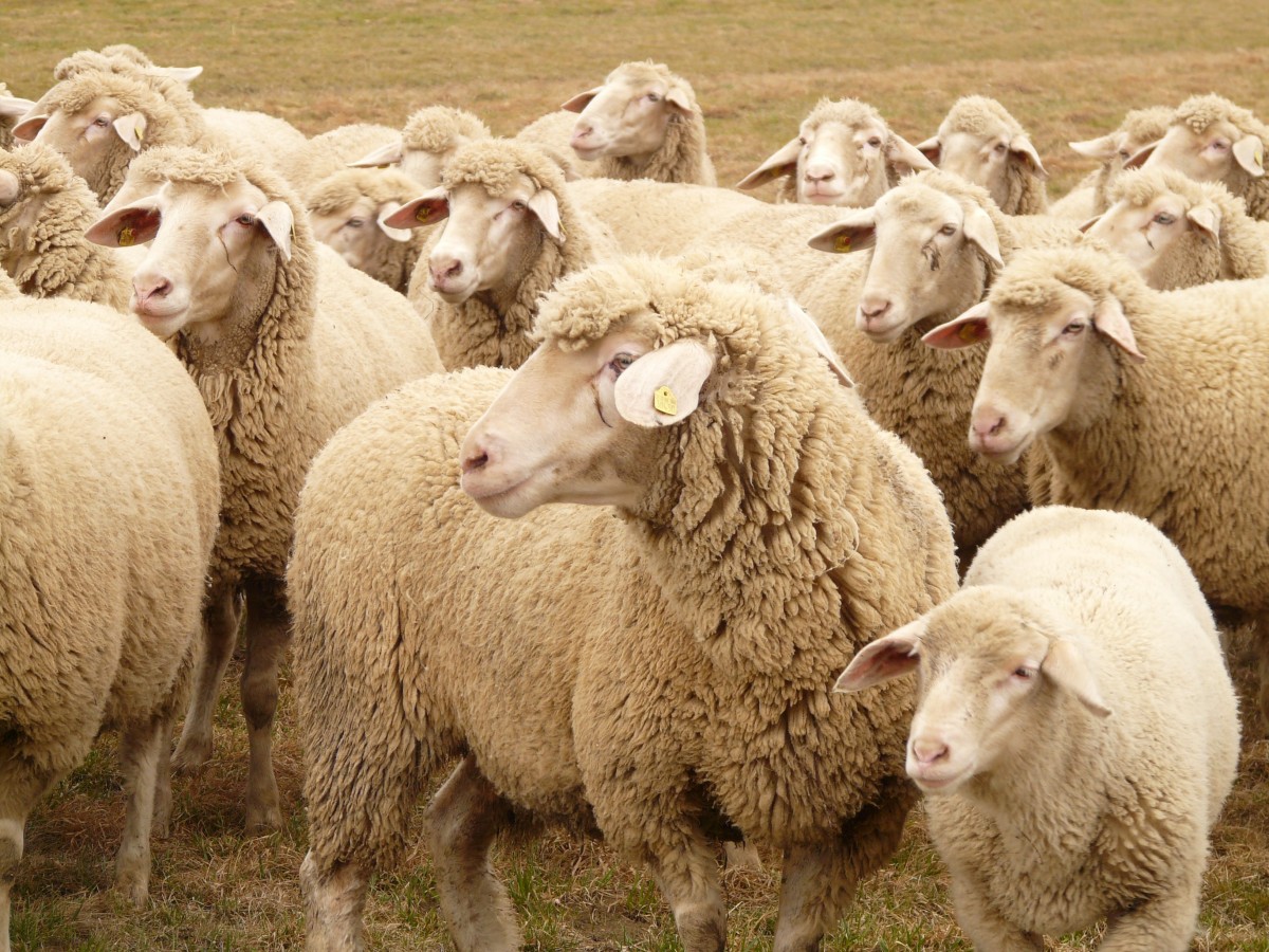
Sheep Breeds
Everyone has heard the fairytale “Baa Baa Black Sheep Have You Any Wool?” but what about the double-coated California Red, the multi-colored Katahdin sheep with hair, or the East Friesian dairy ewe that produces over 1,100 pounds of milk a year? Sheep come in different shapes, sizes, and colors and all of them provide different functions and uses for producers. These can range from meat, wool, and milk production or a combination of characteristics.